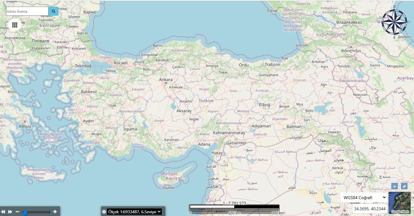
Professional/Operational GIS
Dozens of automation systems operating at the national level (ministries, public institutions) have been built on top of WebGIS Platform.



WebGIS Platform
The most widely used WebGIS software in Turkey’s public sector IT.
OverviewExplore
WebGIS Platform manages corporate map processes with Open Geospatial Consortium compliance, web editing, layer management, media operations, import/export tools, and a high-performance WebGIS infrastructure.
Overview
WebGIS Platform is a web-based Geographic Information System (GIS) solution. It enables institutions to centrally manage, analyze, and visualize their spatial data.
Capabilities
Core Capabilities
The most widely used WebGIS software in Turkey’s public sector IT.
Go to OverviewDozens of automation systems operating at the national level (ministries, public institutions) have been built on top of WebGIS Platform.
It offers users the ability to view, toggle, order, and adjust the transparency of all data layers on the map.
The screen where the activation, visibility, and ordering status of all data layers on the map are managed.
Adding new layers or editing the connection settings of existing layers is done from this screen.
The screen where layer groups are defined and edited for more organized management of map data.
The screen where data queries are performed by license, facility, and coordinate information.
Capability Cards
The main modules are organized as concise corporate summary cards within the current page layout.
Dozens of automation systems operating at the national level (ministries, public institutions) have been built on top of WebGIS Platform.
It offers users the ability to view, toggle, order, and adjust the transparency of all data layers on the map.
The screen where the activation, visibility, and ordering status of all data layers on the map are managed.
The Layer Information Screen lets you track, monitor, and manage the relevant process on a single screen, in line with the corporate workflow.
The Layer Group Information Screen lets you track, monitor, and manage the relevant process on a single screen, in line with the corporate workflow.
The Quick Query Screen lets you track, monitor, and manage the relevant process on a single screen, in line with the corporate workflow.
The Query Screen lets you track, monitor, and manage the relevant process on a single screen, in line with the corporate workflow.
The Drawing Tool Screen lets you track, monitor, and manage the relevant process on a single screen, in line with the corporate workflow.
Prepare and save your thematic maps, keep them data-driven and live, and use and share them whenever you want.
Prepare your choropleth maps. No need to deal with retrieving info, querying data, navigating to data, or toggling layers. Let the choropleth map speak for itself. Let your managers and non-GIS users actively and meaningfully use GIS.
Let your end users modify and edit vector data. Save yourself the burden of working in desktop software. Perform drawing, editing, splitting, trimming, copying, moving, scaling, text writing, deleting, editing, merging, and separating operations conveniently in the web interface.
Resources
You can access presentation and promotional content about WebGIS Platform from this section.
Product Tour
Dozens of automation systems operating at the national level (ministries, public institutions) have been built on top of WebGIS Platform.
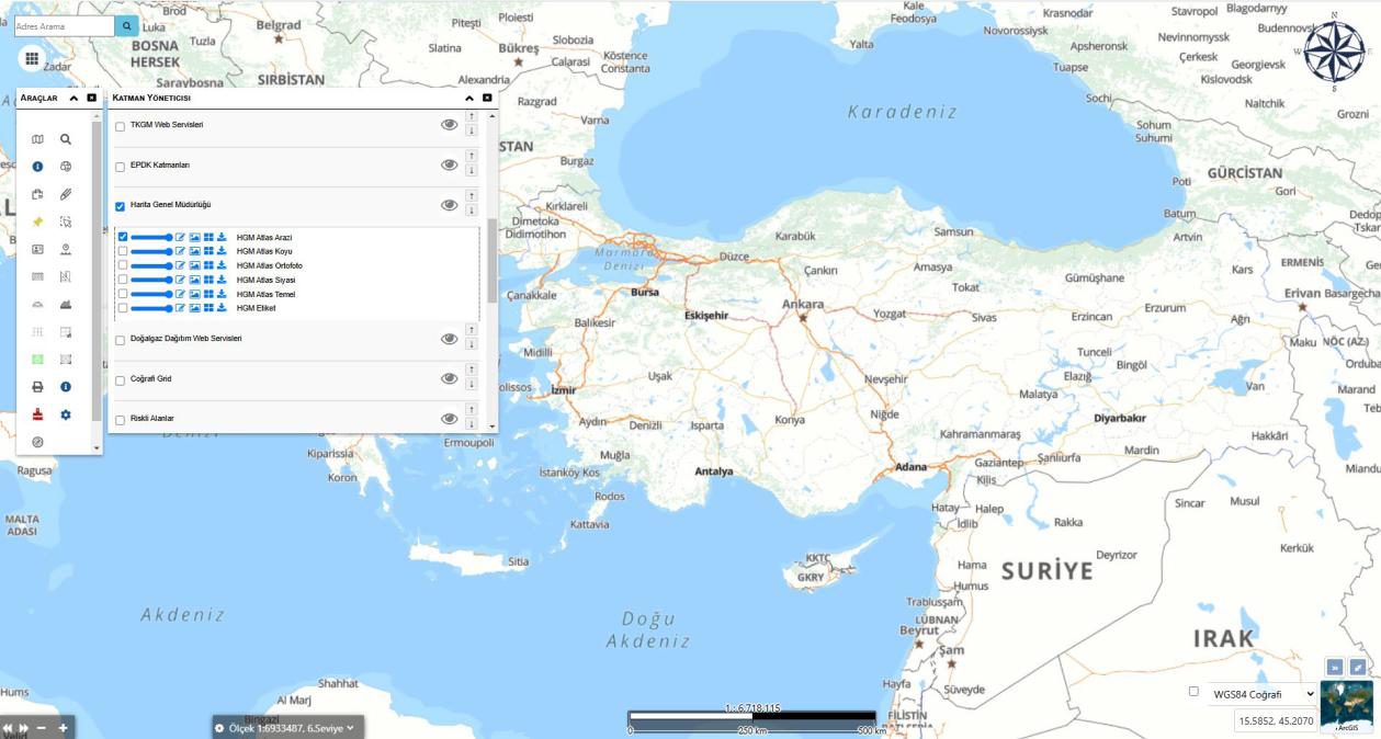
It offers users the ability to view, toggle, order, and adjust the transparency of all data layers on the map.
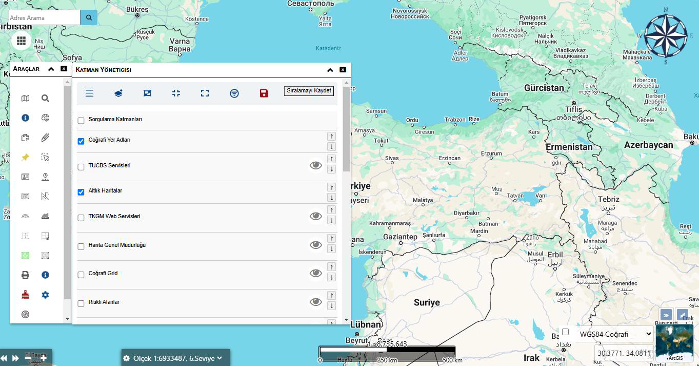
The screen where the activation, visibility, and ordering status of all data layers on the map are managed.
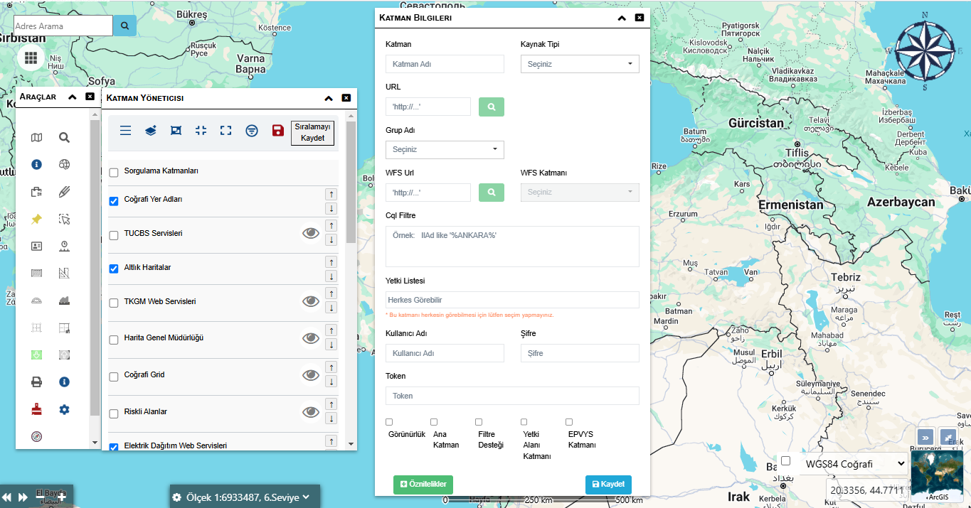
Adding new layers or editing the connection settings of existing layers is done from this screen.
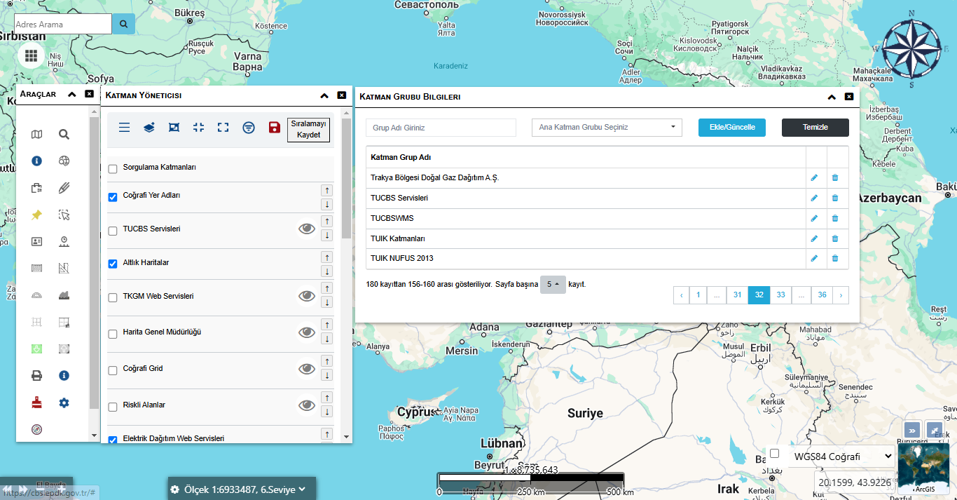
The screen where layer groups are defined and edited for more organized management of map data.
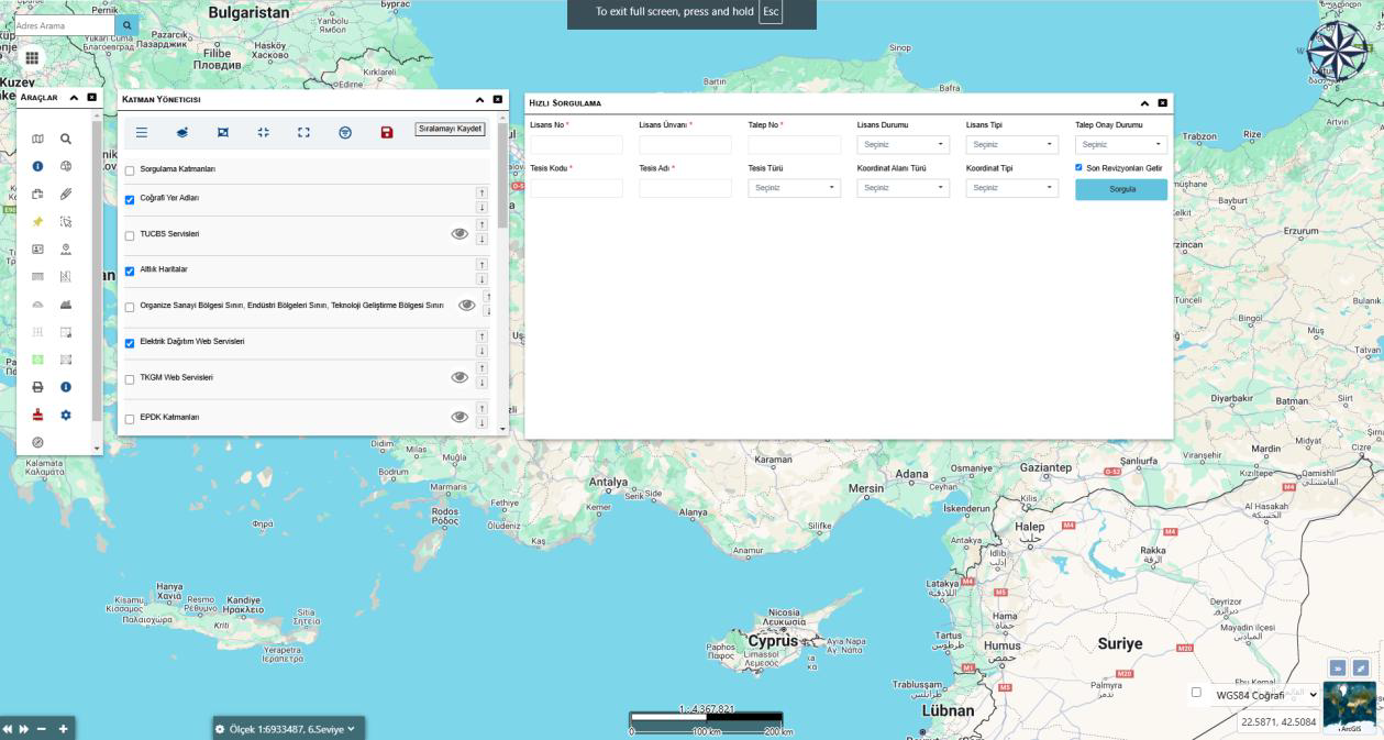
The screen where data queries are performed by license, facility, and coordinate information.
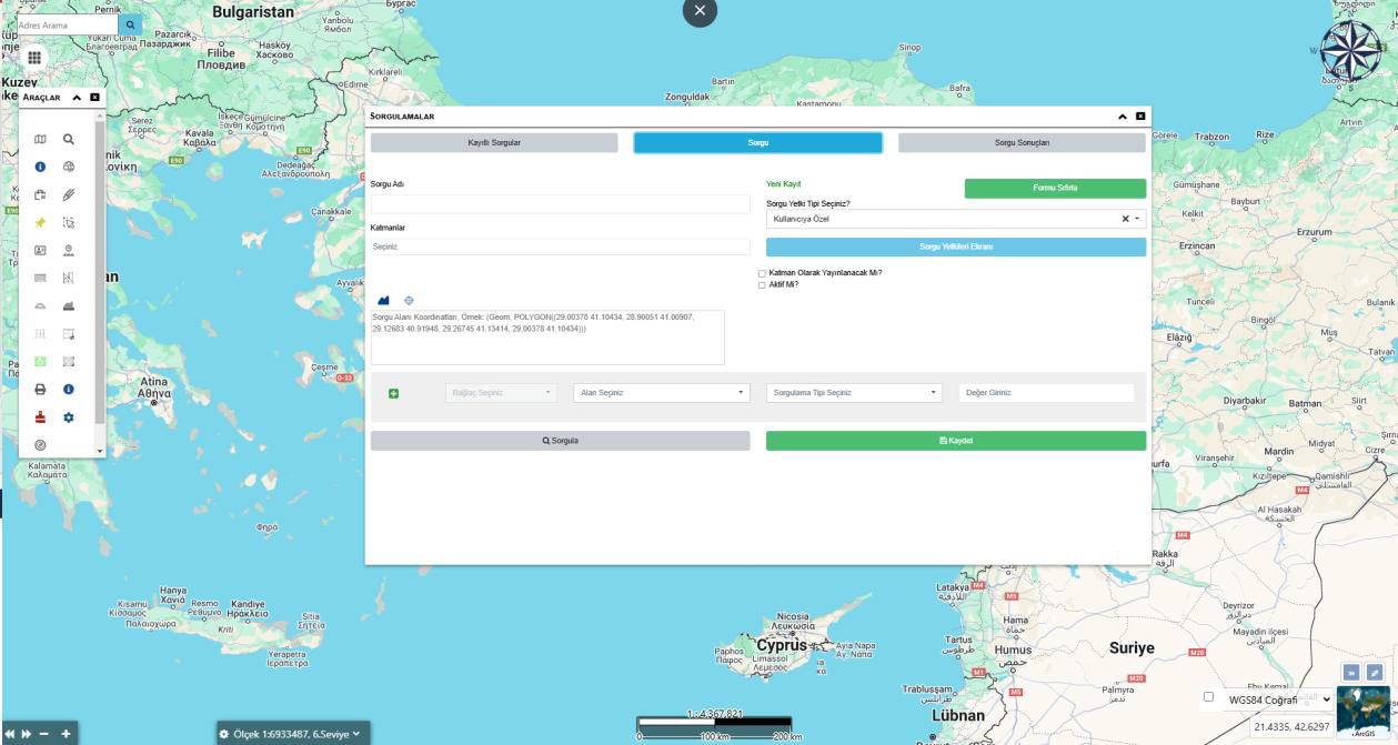
The screen where the user can filter and analyze data belonging to a specific area or layer on the map.
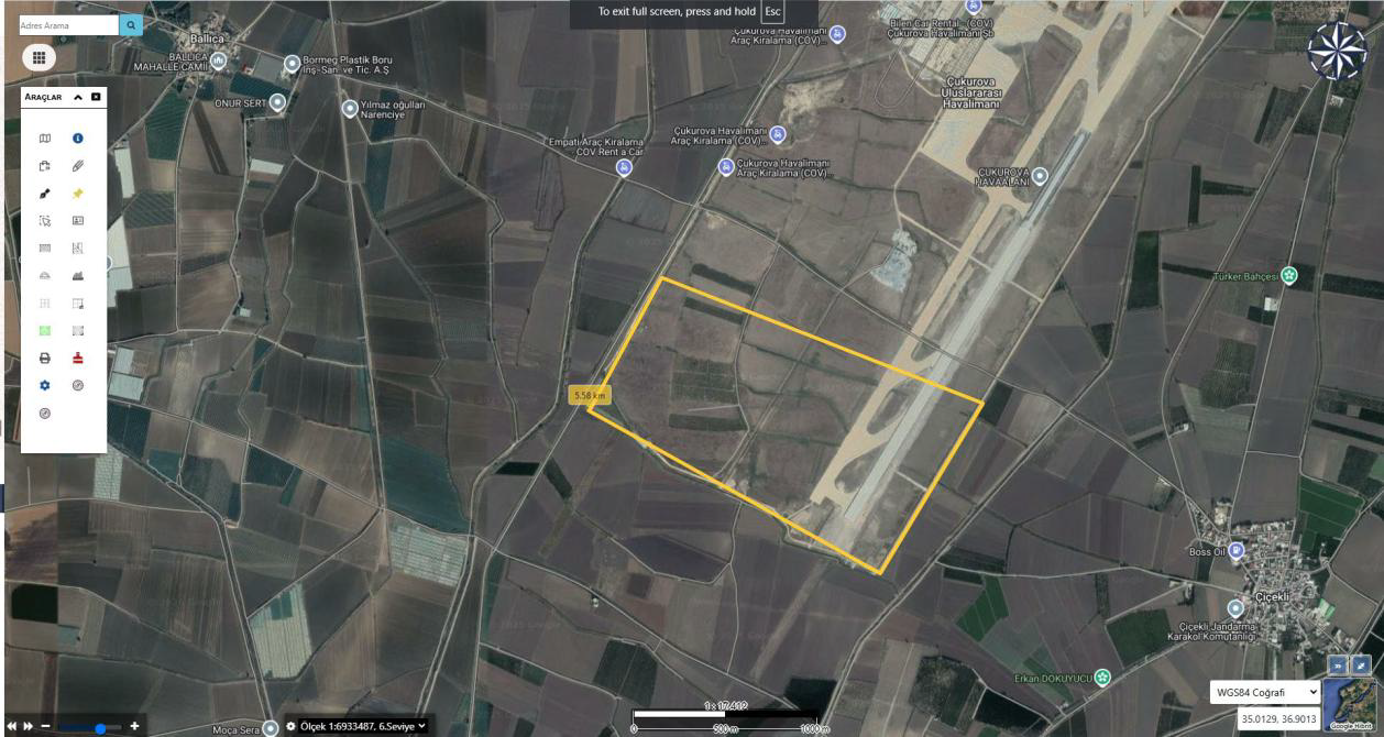
The screen that lets the user define areas by making polygon, line, or point-based geometric drawings on the map.
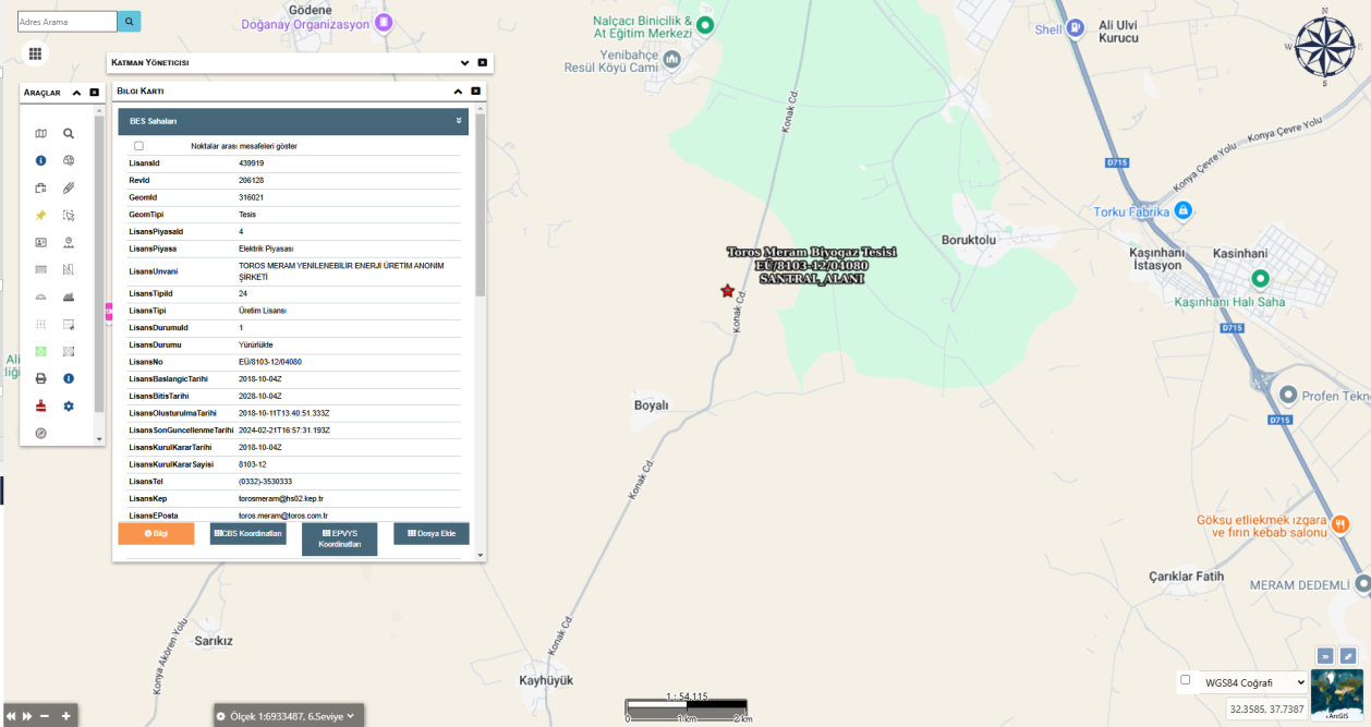
The screen where all detailed information of the selected facility, parcel, or object is listed.
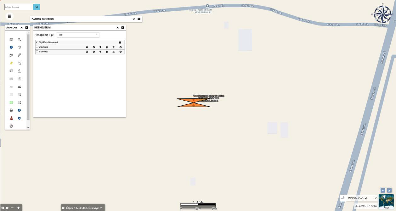
The screen where the user can manage objects created or displayed on the map.
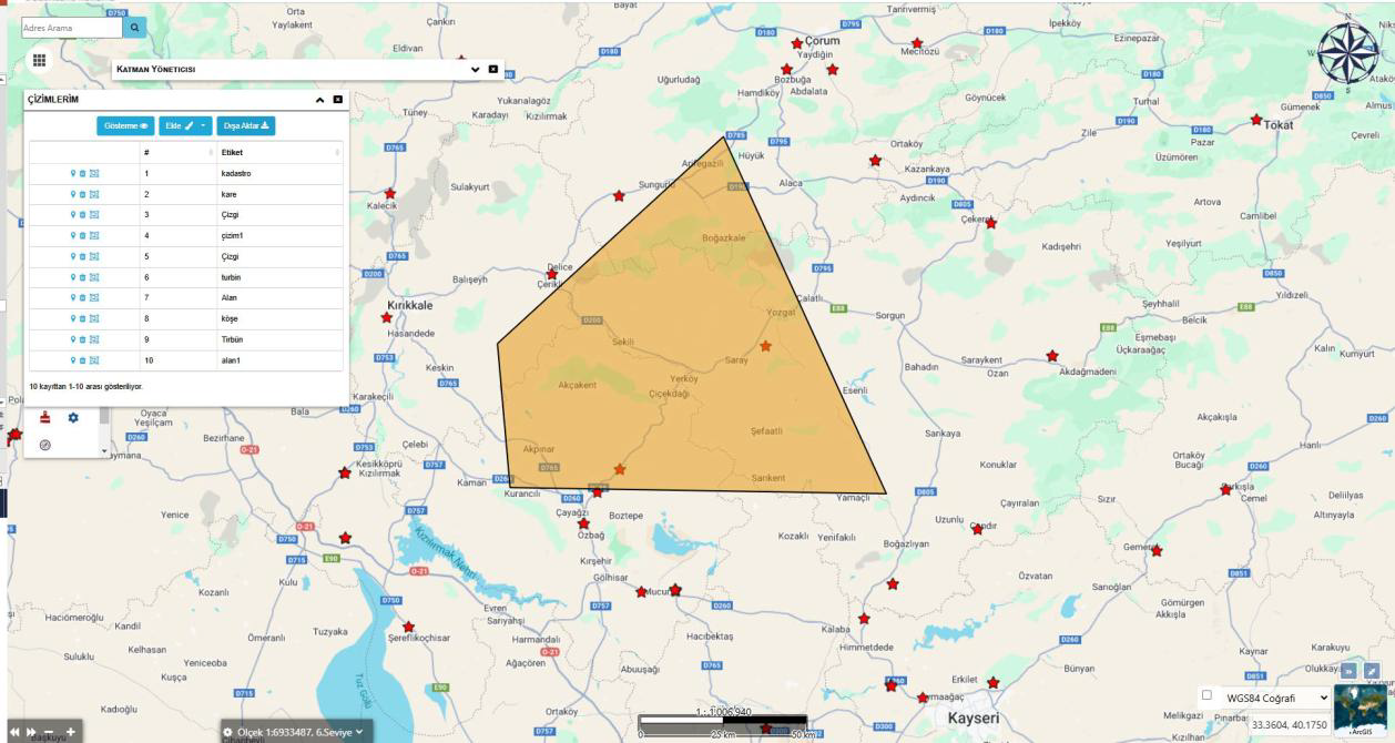
The screen where all drawings created by the user on the map (point, line, area, etc.) are listed and managed.
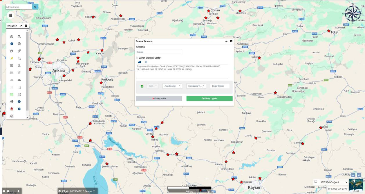
It enables the data on the map to be displayed along the time dimension. The user can filter layers by a specific date range, analyze change processes, and comparatively examine the spatial distribution of historical data.
FAQ
The core use cases and corporate value of the product are summarized here.
Contact UsWebGIS Platform
WebGIS Platform is a web-based Geographic Information System (GIS) solution. It enables institutions to centrally manage, analyze, and visualize their spatial data.